HYDRA-EO 2026: From field measurements to airborne and satellite observations
A multi-country campaign connecting plant measurements, hyperspectral and thermal imaging, and satellite Earth Observation
Campaign update · 27 August 2026
During the 2026 growing season, HYDRA-EO is carrying out an extensive series of field, UAV, airborne, and satellite campaigns across Europe to advance the early detection and monitoring of crop diseases and stress.
The campaigns bring together researchers and partners across the Netherlands, Spain, and Italy. Hyperspectral, thermal, fluorescence, and RGB observations are combined with detailed measurements of plant physiology, biochemistry, crop development, and disease progression.
The objective is to understand how stress and disease modify plant traits and functioning, and how those changes can be detected consistently from individual leaves and plants to UAV, aircraft, and satellite observations.
Plant measurements→Field spectroscopy→UAV→Airborne hyperspectral & thermal→Satellite EO
Monitoring potato health in the Netherlands
In Lelystad, the Wageningen University, Department of Environmental Sciences (WU-DES) team — through the Laboratory of Geo-Information Science and Remote Sensing — conducted five HYDRA-EO UAV campaigns between May and July 2026 over experimental potato fields. Flights on 11 May, 16 June, 25 June, 1 July, and 21 July followed crop development from early growth through flowering and early tuber development.
WU-DES coordinated the multi-sensor observations, combining VNIR hyperspectral imagery, thermal observations, fluorescence and SIF measurements, and RGB imagery with field disease assessments and plant measurements. Together, they provide a detailed time series for investigating how disease and physiological stress evolve during the season.
The final UAV campaign also covered the cloud-free portion of an EnMAP hyperspectral satellite acquisition from 19 July, creating an important opportunity to compare ground, UAV, and satellite observations.
The experimental design includes multiple potato varieties with contrasting susceptibility to viral and bacterial diseases. The primary disease targets are Potato virus Y (PVY) and Erwinia spp., associated with bacterial soft rot and blackleg, with Potato Leaf Curl Virus monitored as a secondary viral target. The trial combines different varieties with known disease positions and treatments, which is especially valuable for studying how the spectral and physiological signal changes with variety, disease, and time in the season — including the interaction between viral and bacterial pathogens and variability in soil moisture. Comparing variety- and disease-specific plots throughout the season allows the team to relate visible symptom development to the spectral and thermal signals captured from the UAV and satellite platforms.
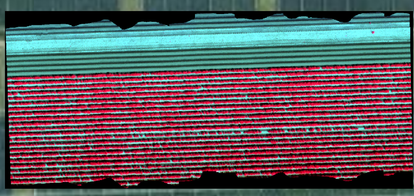
June hyperspectral campaign. False-colour UAV mosaic showing the spatial structure of the experimental potato plots.
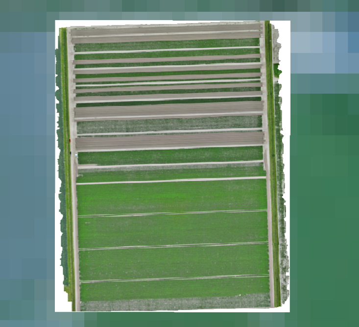
21 July UAV acquisition. High-resolution view of the potato experiment during the final UAV campaign.
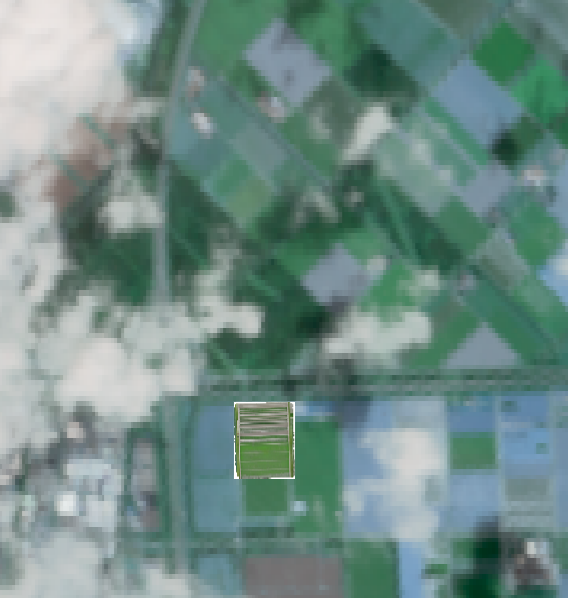
Connecting UAV and satellite scales. The UAV acquisition footprint is shown within the partly cloud-free EnMAP scene acquired on 19 July 2026.
Alongside the airborne and satellite acquisitions, the WU-DES field team photographs the trial plots on the ground throughout the season. These images document the different potato varieties and disease treatments side by side, including the visible contrast between healthy canopy and the early senescence associated with viral and Erwinia infection, and provide the ground truth needed to interpret the UAV and satellite signals.
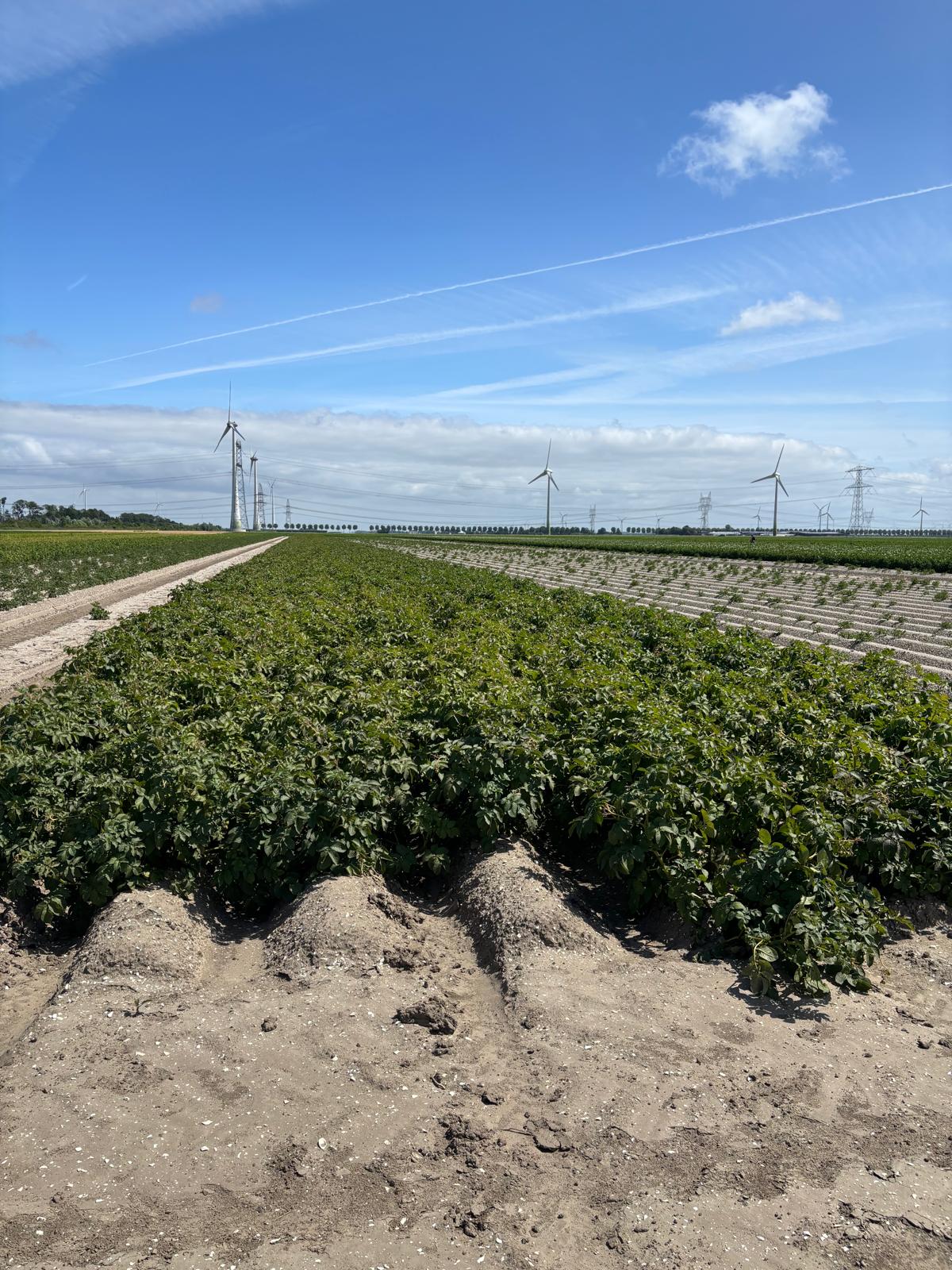
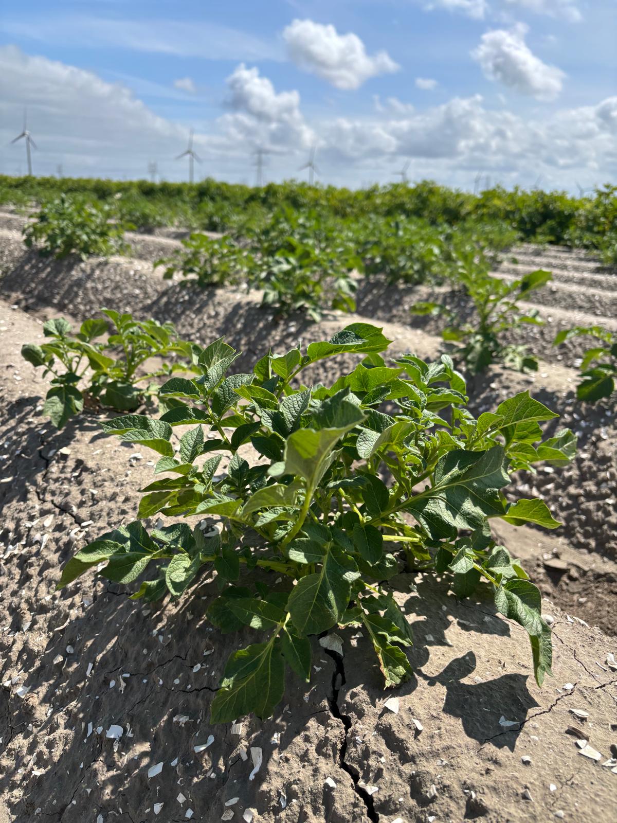
Early-season trial plots. Young potato plants on the ridged rows of the multi-variety disease trial, photographed shortly after emergence.
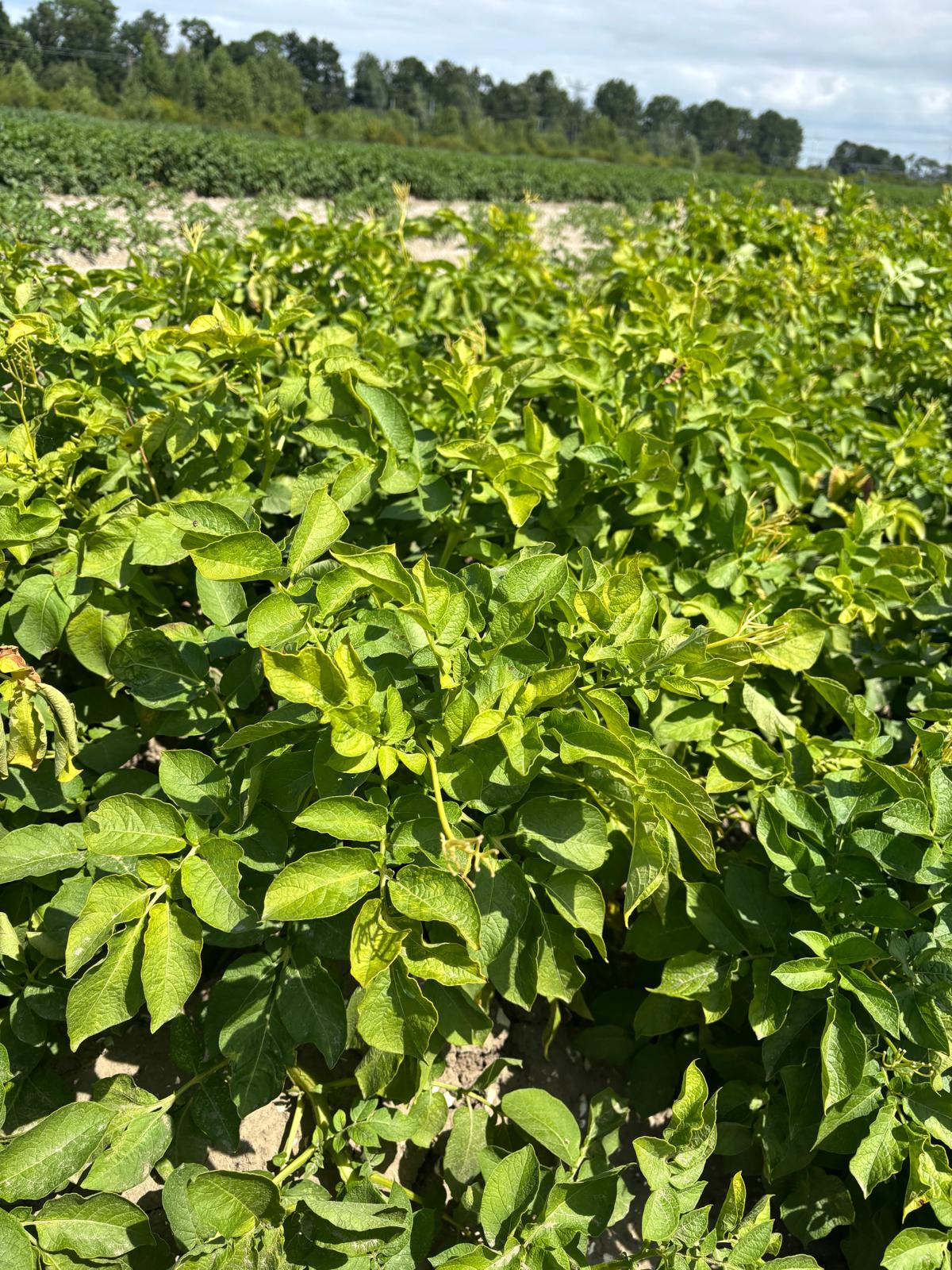
Canopy ground reference. Detailed view of canopy foliage colour and structure, used to interpret the hyperspectral, thermal, and RGB imagery collected overhead.
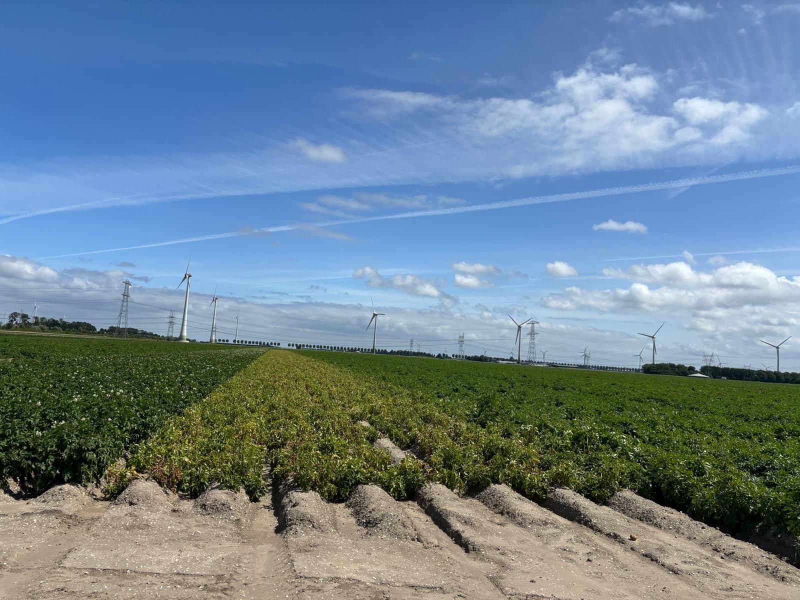
Comparing varieties and disease treatments in the field. A trial row showing early canopy senescence stands out against neighbouring rows of other varieties, illustrating the plot-to-plot contrast in disease response that the UAV and satellite sensors are designed to detect.
Repeated ground documentation. Photographs taken across successive field visits track how canopy condition evolves differently between varieties and disease treatments as the season progresses.
Airborne monitoring of olive and pistachio in Spain
At El Chaparrillo in Ciudad Real, HYDRA-EO is conducting repeated airborne and field campaigns over olive and pistachio orchards. A first major campaign was completed in June 2026, combining aircraft observations, extensive field measurements, and an EnMAP hyperspectral satellite acquisition.
A second major campaign is scheduled for 31 August-5 September 2026. The aircraft will simultaneously acquire VNIR and SWIR hyperspectral imagery and thermal observations, while teams on the ground collect complementary spectral, physiological, biochemical, and disease-related measurements.
The pistachio experiments include trees affected by different fungal diseases. This creates an opportunity to investigate whether combinations of hyperspectral and thermal observations can separate disease-related changes from other sources of plant variability. Repeated measurements are essential: the challenge is not only to identify symptomatic plants, but to determine when physiological changes first become detectable.
In Ciudad Real, the olive disease work focuses primarily on Spilocaea oleaginea (peacock spot) and Pseudomonas savastanoi pv. savastanoi (olive knot). Bactrocera oleae (olive fruit fly) is treated as a secondary target, monitored when confirmed field incidence is present. The design includes plots under different soil management regimes, together with a dedicated plot of nine olive varieties, allowing the team to compare differences in stress response driven by management practice versus variety. This work is also connected to other European surveillance systems for P. savastanoi and B. oleae.
For pistachio, the two primary disease groups are Septoria spp. and fungi of the Botryosphaeriaceae family, with Alternaria alternata and Botrytis cinerea monitored as secondary targets. The pistachio experiments span a wide diversity of varieties and rootstocks under contrasting rainfed and irrigated management, and the project aims to integrate hyperspectral phenotyping with genetic and GWAS data — connecting molecular, genomic, and spectral information in pistachio and olive is one of the scientific gaps HYDRA-EO aims to address.
For this summer's analysis, the initial disease classes are being kept simple: Healthy → Primary disease 1 → Primary disease 2 → Other disease/pest → Unknown/abiotic stress. This avoids forcing trees or plants with unconfirmed symptoms into a specific named disease, and lets the classes be cross-referenced with traits such as Cab, Car, Anth, N, LWC, gs, temperature, and SIF.
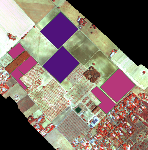
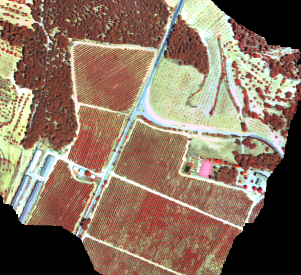
El Chaparrillo campaign area. Airborne coverage of the agricultural experiments and surrounding orchards on 12 June 2026.
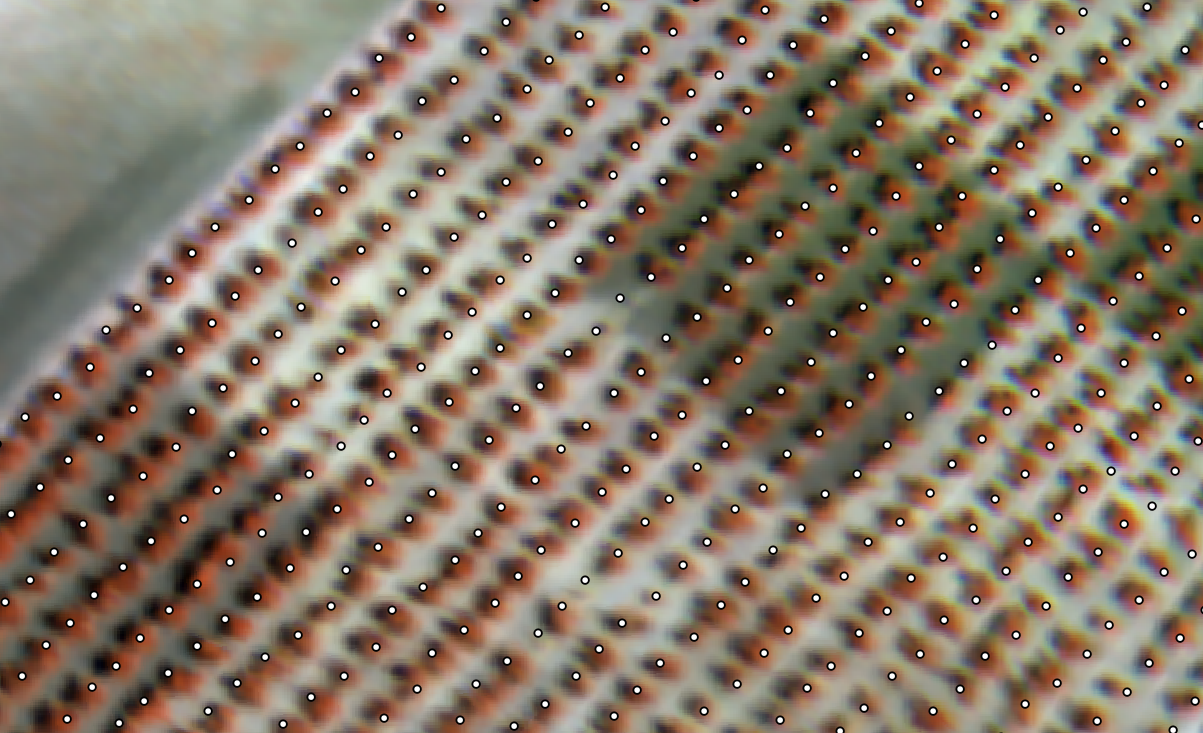
From orchard to individual crowns. Detailed imagery supports the connection between tree-level reference measurements and airborne signals.
Following disease development in Italian vineyards
Since June 2026, HYDRA-EO has been running a series of campaigns in Italian vineyards and at an alfalfa reference site, combining airborne VNIR-SWIR hyperspectral and thermal observations with field spectroscopy and physiological measurements. A coordinated campaign with CNR-IBE in the Bologna region in early August 2026 captured vineyards under different health conditions, building on measurements collected since the start of the growing season.
A further measurement campaign in early September 2026 targets vineyards affected by Flavescence dorée, continuing the repeated observations carried out since June. These repeated observations help determine how disease affects canopy spectral properties, temperature, and plant functioning, and whether these signals remain detectable when moving from individual plants to larger spatial scales. Disease status in the vineyards is confirmed through qPCR testing and visual inspection, with CNR-IBE and the University of Florence as the groups involved in this ground-truthing work.
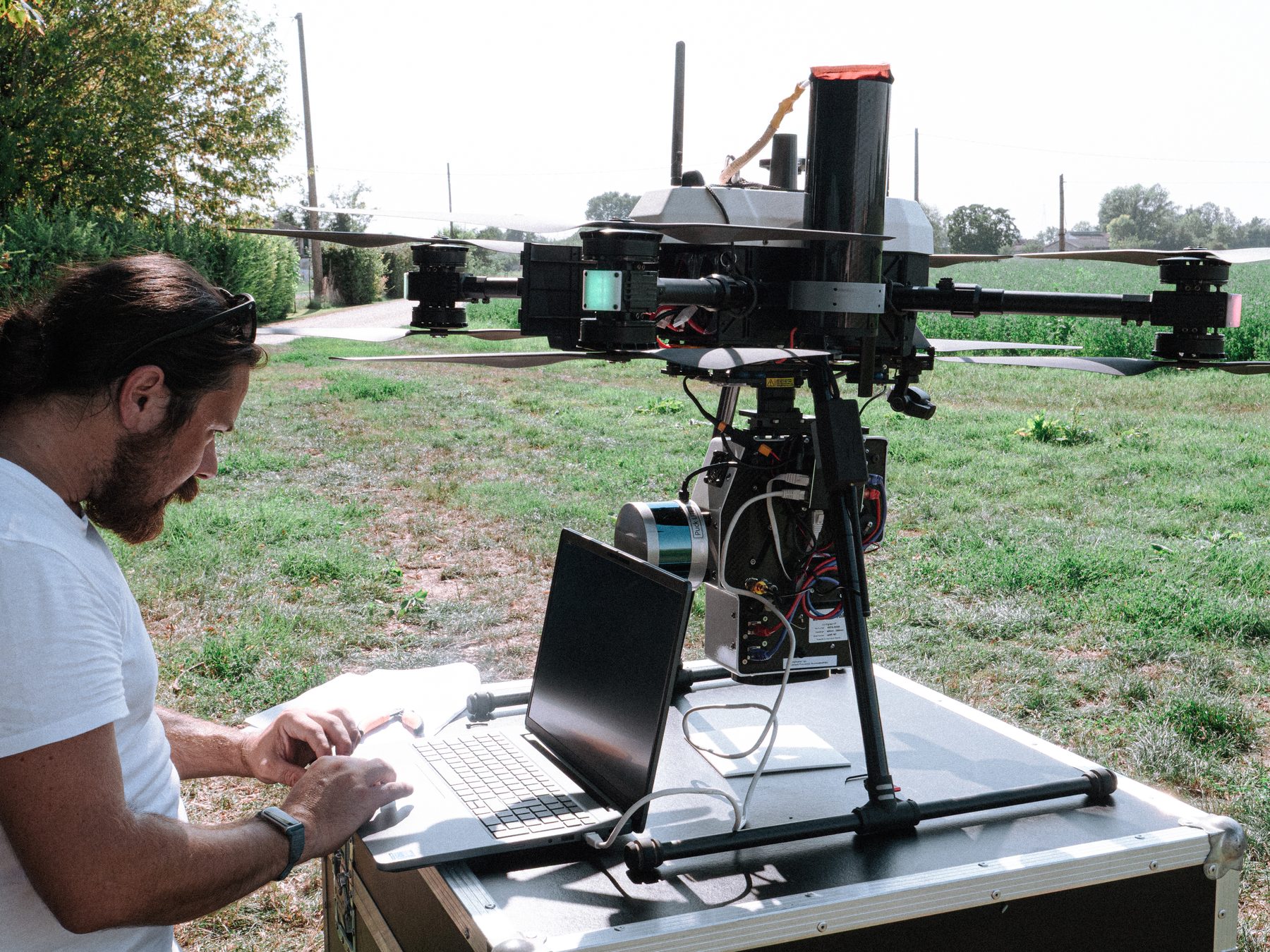
Airborne acquisitions are carried out in partnership with the Institute of BioEconomy of the Italian National Research Council (CNR-IBE), who operate a Headwall sensor system combining VNIR-SWIR hyperspectral imaging with a LiDAR scanner on a UAV platform. Flying this combined sensor package makes it possible to relate canopy spectral signals directly to three-dimensional canopy structure. In parallel, field teams collect spectroradiometer measurements directly on the vine canopy in the Chianti hills, providing the ground reference spectra needed to interpret the airborne imagery.
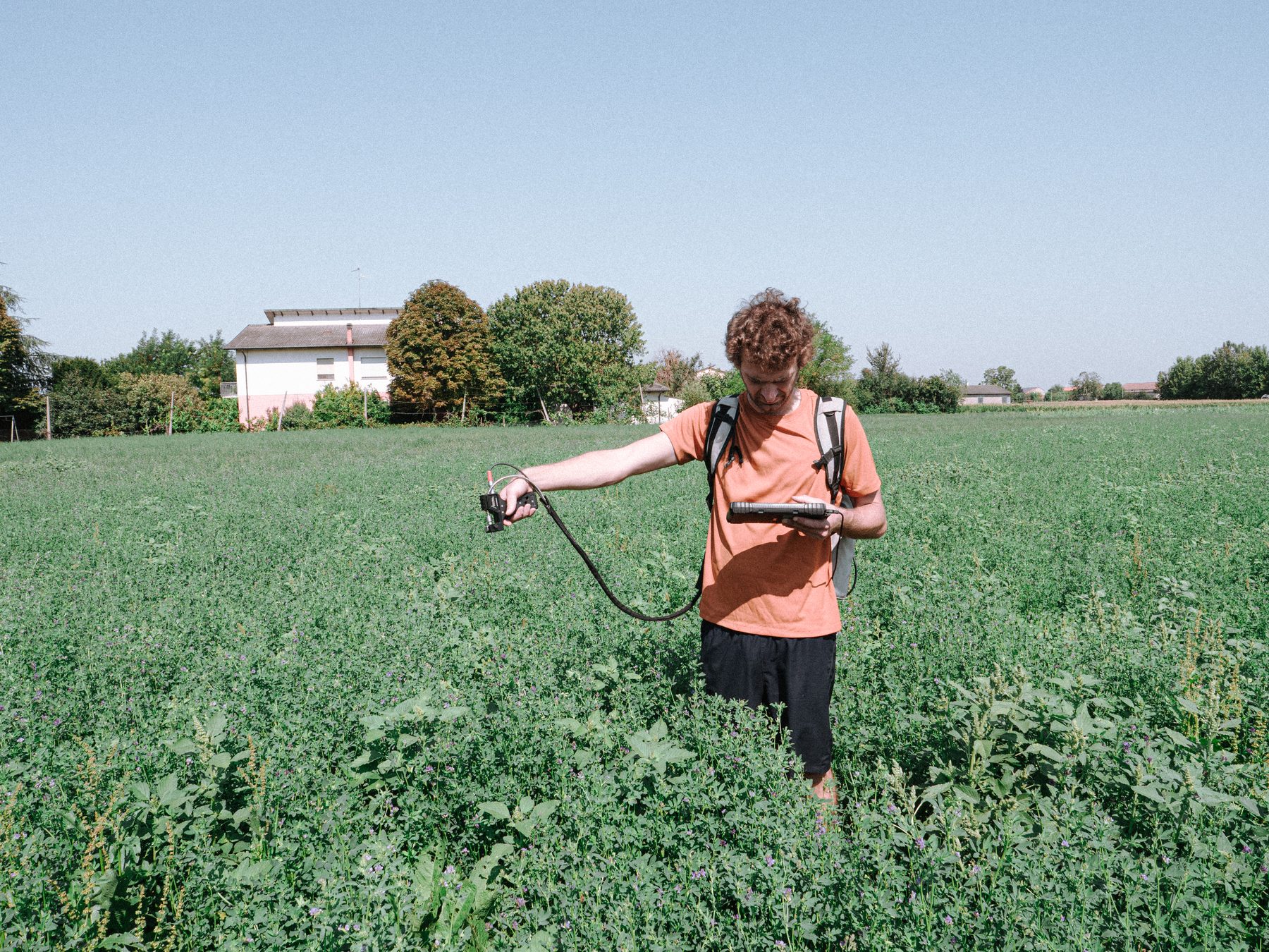
A permanently installed FloX system, powered by solar panels and sited in a reference alfalfa field, continuously records canopy reflectance and solar-induced fluorescence throughout the season. This automated station complements the vineyard campaigns with a long-term, weather-independent calibration and validation record. Compact UAV-mounted hyperspectral sensors are also being trialled during the July 2026 field campaign, extending the observation chain between handheld field instruments and full airborne acquisitions.
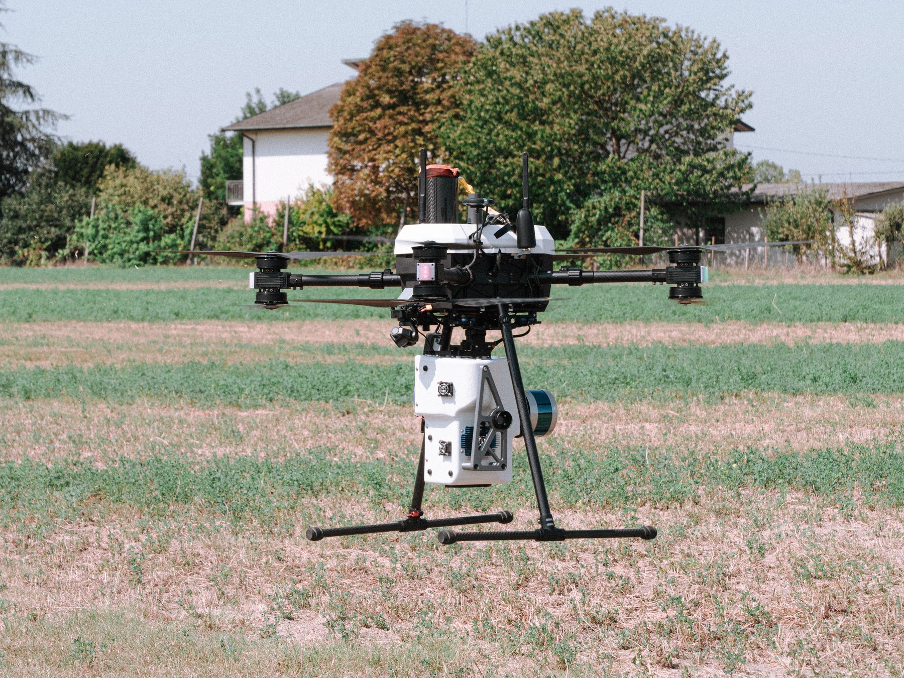
Headwall VNIR-SWIR + LiDAR sensor. Operated by CNR-IBE, this UAV-mounted system combines hyperspectral imaging with LiDAR to link canopy spectra with 3D structure.
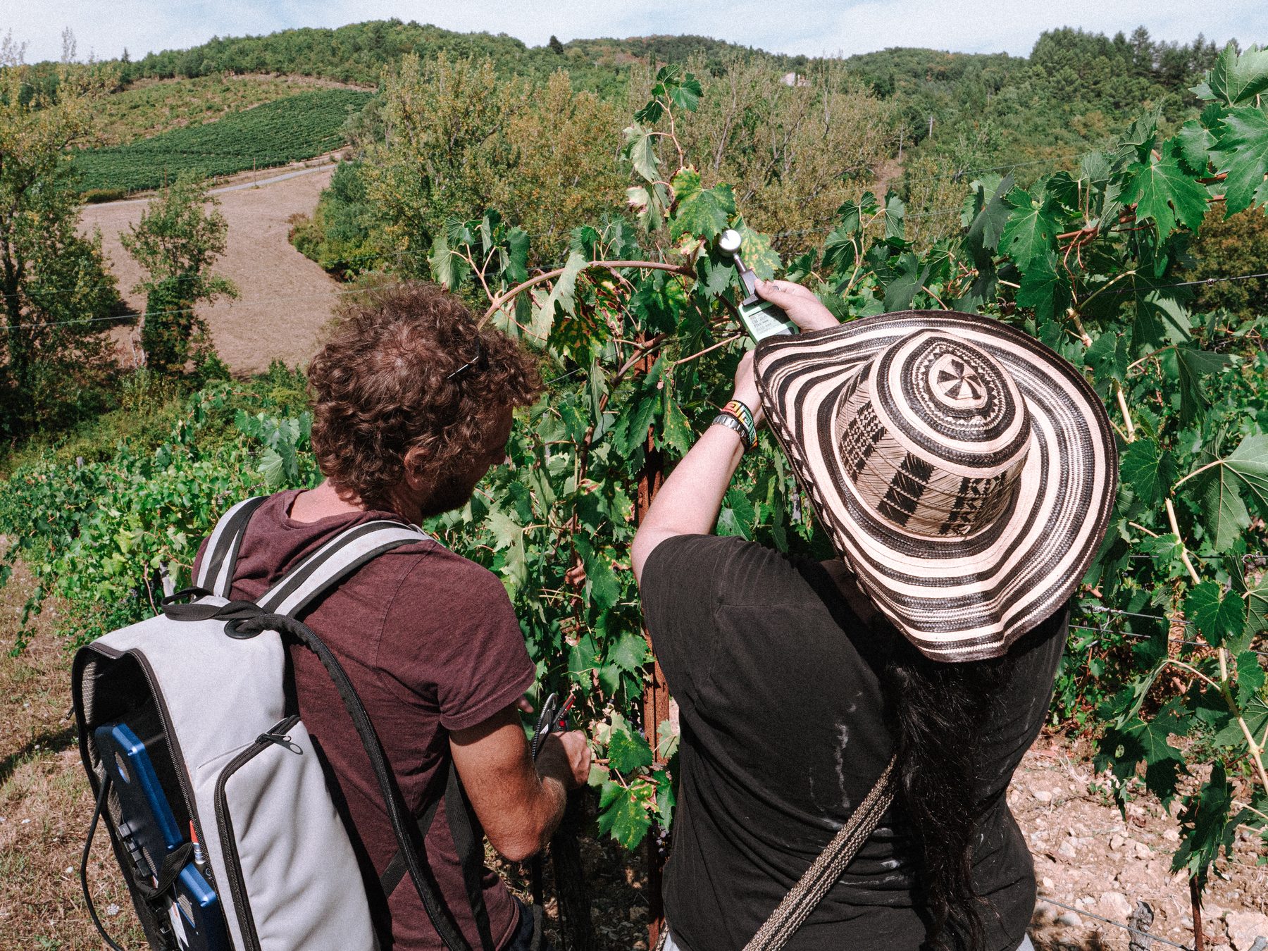
Field spectroscopy in Chianti. Ground-based spectroradiometer measurements on vine canopies provide reference spectra for the airborne Headwall acquisitions.
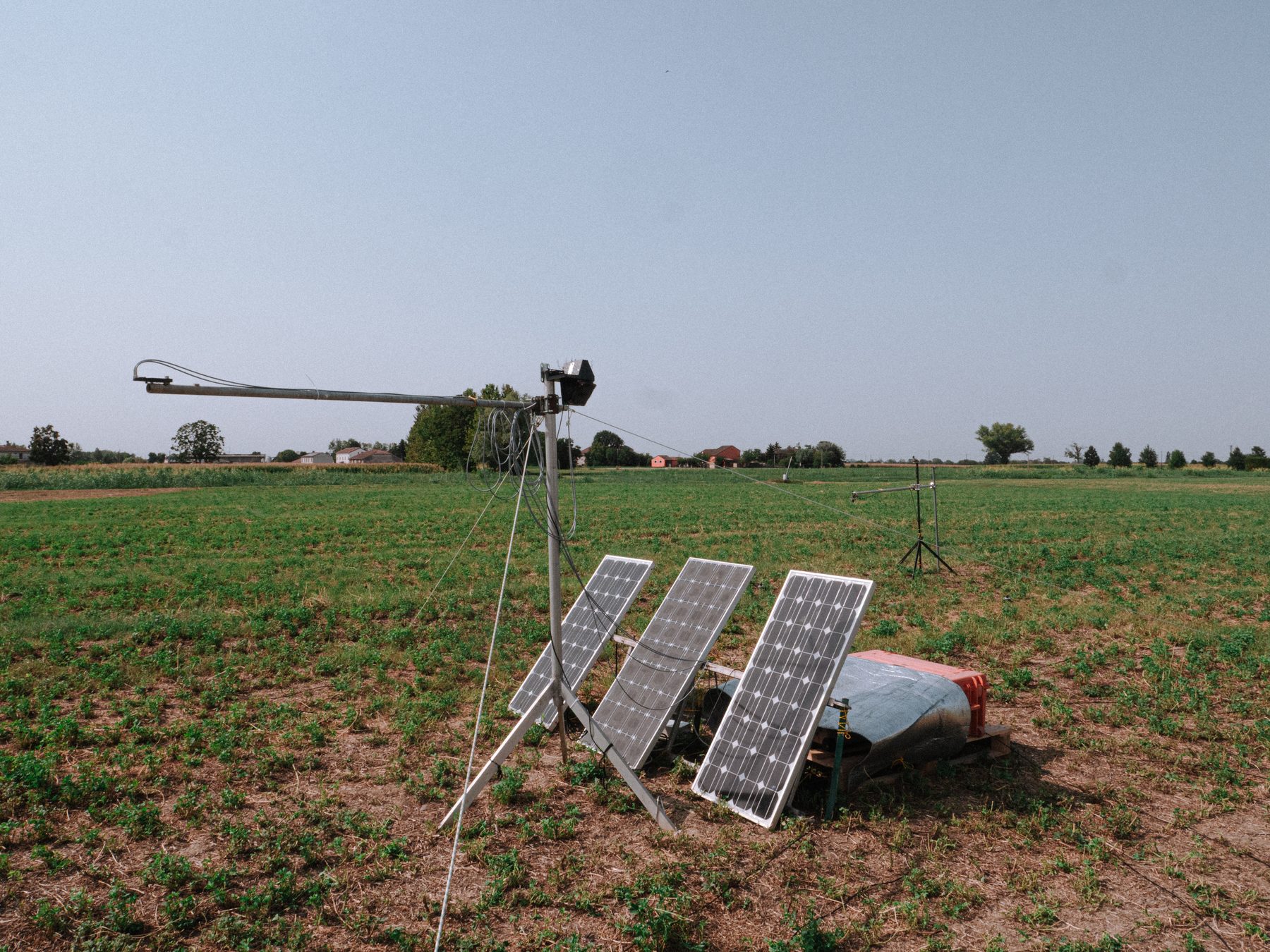
Continuous monitoring with FloX. A solar-powered FloX station installed in a reference alfalfa field records canopy reflectance and solar-induced fluorescence throughout the season, providing a long-term calibration and validation record for the Italian campaigns.
Compact hyperspectral payload. A lightweight, UAV-mounted “nano” hyperspectral sensor being prepared for flight, extending coverage between field and full airborne scales.
Field campaign, July 2026. A CNR-IBE colleague collecting field spectral measurements as part of the Italian campaign season.
Expanding observations through European collaboration
HYDRA-EO works with complementary European projects, research institutes, and regional plant-health services to extend observations beyond its core sites and test methods under real disease-management conditions.
In Italy, collaboration with the CERBERUS project and CNR-IBE (Institute of BioEconomy, Italian National Research Council) in Bologna supports repeated monitoring of vineyards affected by Flavescence dorée. The campaigns carried out since June, including the early-August and early-September acquisitions, provide observations under different seasonal and physiological conditions.
On 2 September 2026, a joint field team from CNR-IBE and the Department of Agricultural and Food Sciences, University of Bologna carried out ground measurements in the CERBERUS vineyards, combining field spectroradiometer readings, SPAD (leaf chlorophyll) measurements, and visual disease inspection. This ground-truthing adds another point to the Flavescence dorée time series and supports the interpretation of the airborne hyperspectral and thermal acquisitions collected over the same vineyards.
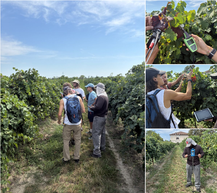
CERBERUS field campaign, 2 September 2026. The CNR-IBE and University of Bologna team taking spectroradiometer, SPAD, and visual disease measurements in the vineyards near Bologna.
In Valencia, HYDRA-EO collaborates with CERBERUS and the Servicio de Sanidad Vegetal of the Generalitat Valenciana. Airborne observations cover olive orchards and other priority areas identified by plant-health authorities, including sites relevant to the surveillance of insect vectors associated with Xylella fastidiosa. This connects advanced Earth Observation technologies with operational plant-health surveillance.
Building on this, CNR-IBE, together with Wageningen University, Department of Environmental Sciences (WU-DES), is planning a further CERBERUS airborne mission for late September 2026 over areas affected by Xylella fastidiosa, carried out in collaboration with CEU Cardenal Herrera University. This mission extends CERBERUS Earth Observation testing to an additional vector-borne disease system, linking the Italian and Spanish arms of the project.
Valencia collaboration. Airborne observations extend HYDRA-EO testing to additional crops, landscapes, and operational plant-health priorities.
The El Chaparrillo campaigns are conducted by Wageningen University, Department of Environmental Sciences (WU-DES) in collaboration with CIAG-IRIAF and IAS-CSIC. The partnership combines WU-DES expertise in airborne and satellite Earth Observation with crop pathology, field experimentation, and plant physiology. Together, the partners provide the reference information needed to interpret hyperspectral and thermal signals from olive and pistachio systems.
Together, these collaborations expand HYDRA-EO across crops, diseases, environmental conditions, and monitoring frameworks. They also provide independent datasets for testing whether methods developed at individual sites can transfer across locations, sensors, and disease systems.
Connecting observations across scales
The 2026 campaigns are creating one of HYDRA-EO’s core experimental datasets. By connecting plant measurements, field spectroscopy, UAV observations, airborne hyperspectral and thermal imagery, and satellite Earth Observation, the project can investigate the same biological processes at complementary spatial scales.
These observations will support the development and validation of approaches that combine radiative transfer modelling, plant physiological information, and artificial intelligence to detect crop stress and disease while explaining the underlying changes in plant functioning.
The campaign season will conclude with the late-summer acquisitions in Spain and Italy, completing a unique multi-country dataset for the next stages of HYDRA-EO research and development.
Continue exploring
Scientific pipeline RTM-Suite tools Project timeline All project news Consortium
© 2026 HYDRA-EO.
HYDRA-EO is funded by the European Space Agency (ESA) under the EXPRO+ Tender “Crop Multiple Stressors, Pests and Diseases”. Action 1-12684.